
Route planning is one of the most important skills for a bicyclist. A good route can provide shade, interesting sights, quiet roads, and pleasant terrain. A bad route can be busy, devoid of scenery, and dangerous.
For those of us in the suburbs, learning a few basics about route planning can make all of the difference. This is especially true for short errands by bicycle.
I often take my eBike to the grocery store. If I take the shortest route, my favorite grocer is only a half mile away. The road has a painted bicycle lane, but it has a 45 mile per hour speed limit, two lanes in each direction, a painted median, and numerous businesses. It also travels through one of the most dangerous intersections in Chandler.
I’ve never had any close calls, but I’m also an experienced bicyclist. It wouldn’t be pleasant for a beginner cyclist.
Meanwhile, if I add another half-mile, my route to the same destination has tree-lined streets, low speed limits (25-35 mph), and quiet roads. The ride is safer, quieter, and more interesting.
A perfect world would have lower speed limits and better bike infrastructure everywhere, but we also have to navigate the reality in which we live.
Both of these photos below travel to the same destination. As a bicyclist, which would you prefer to ride?
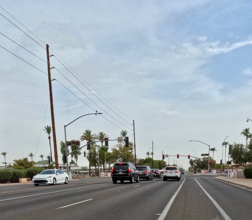
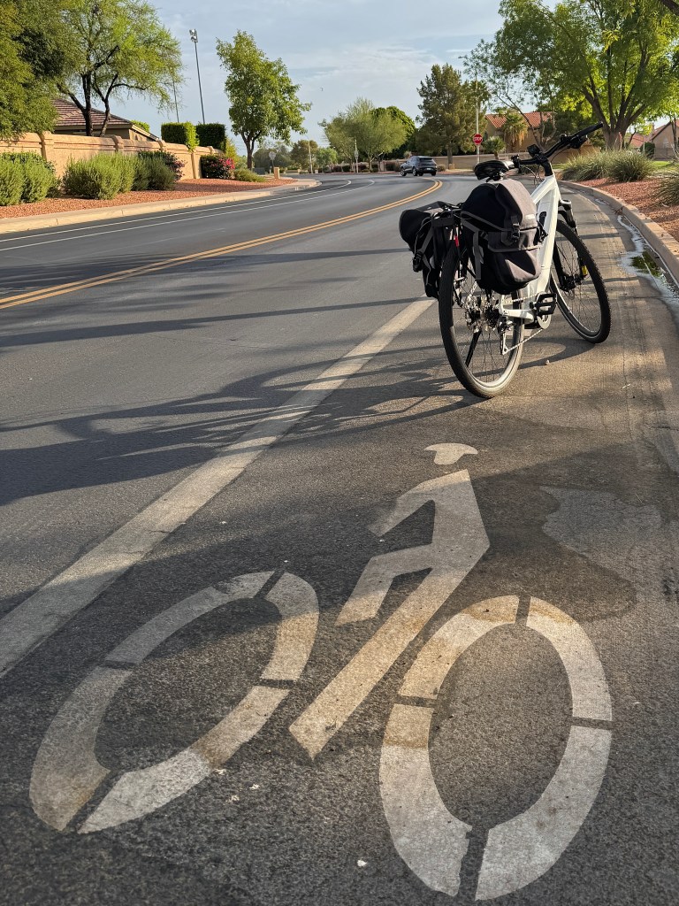
Check Posted Speed Limits
The posted speed limit can provide insight into the road’s atmosphere.
A residential street with a 25 mile per hour speed limit is likely to have less traffic, less noise, and more driver awareness. It’s even better if the road has a bike lane.
35 mile per hour streets with bike lanes can be comfortable to ride. There’s still a designated space for bicyclists and drivers tend to be more likely to expect us. If there’s no bike lane, it’s a judgment call.
I’ve seen some 35 mph roads that have hardly any cars and were a joy to ride. But, I’ve also ridden others with no shoulder, blind corners, and no safe passing opportunities for drivers.
If a road is posted 45 miles per hour, I’ll consider it when it includes a reasonable bike lane. There are times when no alternative is available and I need to follow that road to connect to another quieter route.
In the Phoenix metropolitan area, I avoid 45 mile per hour roads which don’t have bike lanes.
Scout for Safe Crossing Locations
Crossing major roads can be a challenge for bicyclists. It can be difficult to get across arterial streets when there isn’t a traffic signal.
By planning a route ahead of time, you can look at maps and determine if a safe option exists for crossing. Take advantage of satellite views, street-level views, or map layers.
When your route intersects a major road, what does it look like? Do you see traffic lights? Stop signs? Can you tell how busy the arterial road is?
I used to have a favorite route which traveled through a rare portion of undeveloped land in Chandler. It intersects a truck route which has gotten busier. The rest of the route is excellent, but I can’t safely cross. A traffic signal doesn’t exist and traffic is heavy.
I adapted my route by traveling another half mile to an intersection with a signal. It’s not ideal, but it’s safer.
Look for Landscaping
During the height of the pandemic, I took an online course titled “Unraveling the Cycling City” through Coursera and the University of Amsterdam. The class covered the many facets of Dutch cycling culture.
North America is fundamentally different than the Netherlands in many ways. Our cities are more sprawling, our governance structure is different, and our culture is based on one hundred years of car dependence.
Despite these differences, there are universal concepts that we can apply to our preferred bike routes today. One of these core concepts is that bicyclists prefer interesting scenery.
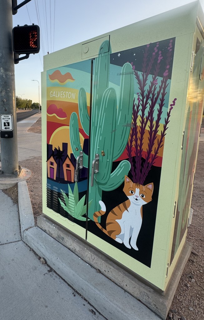
A bicyclist would rather ride along a route with tree-lined streets, scenery that varies, and interesting landmarks.
This is different from how we build highways for cars. We don’t want motorists driving 65 miles per hour and distracted by scenery. So, our highways and arterial streets are built like pipelines. It’s about moving as many cars as efficiently as possible.
By prioritizing scenery, you can make your rides interesting. The scenery doesn’t have to be grandiose. It’s just what you have available in your area.
Can you ride past a park rather than a shopping center? If so, incorporate it into your route.
Develop Your Mental Map
By experiencing your neighborhood by bicycle, you can find new routes, new landmarks, and new quirks about your area. It takes time to discover the best routes and trial-and-error is involved. Be willing to reroute if you don’t feel safe or you run into an obstacle. However, don’t decide your route based on the shortest route by car, because you’re probably missing out.
This article was written and edited entirely by a human. By supporting this website, you’re supporting human-generated content. Thank you! Please ride safely and follow the traffic laws for your area. Ride within your comfort level.


Leave a comment